rareoldprints.com


Search

If you know the reference number
enter it here:


If you enter more than one word
it will be treated as phrase.

Insert "and" or "or" between words to search for the words in any order.

Refine your search here or build another search.
Displaying 10 to 20 of 22 - Next - Previous
93%
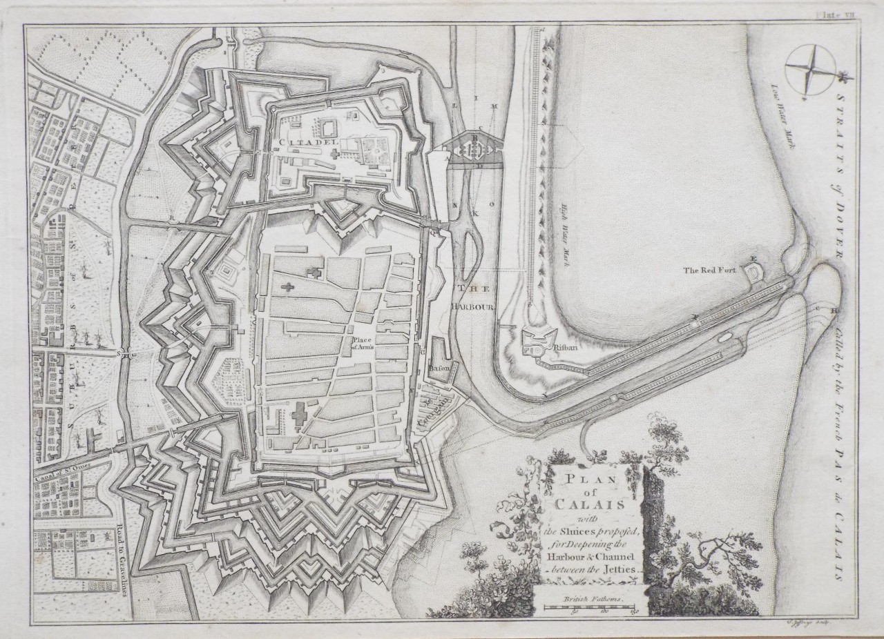
Plan of Calais with the Sluices proposed, for Deepening the Harbour and Channel between the Jetties.
Ref: P/28280
Region: Calais
Type: Copper
Engraver: Jefferys T

93%
Plan of the City and Castle of Caen.
Ref: P/28279
Region: Caen
Type: Copper
Engraver: Jefferys T

93%
Plan of the City of Rouen the Capital of Normandy
Ref: P/28278
Region: Rouen
Type: Copper
Engraver: Jefferys T

93%
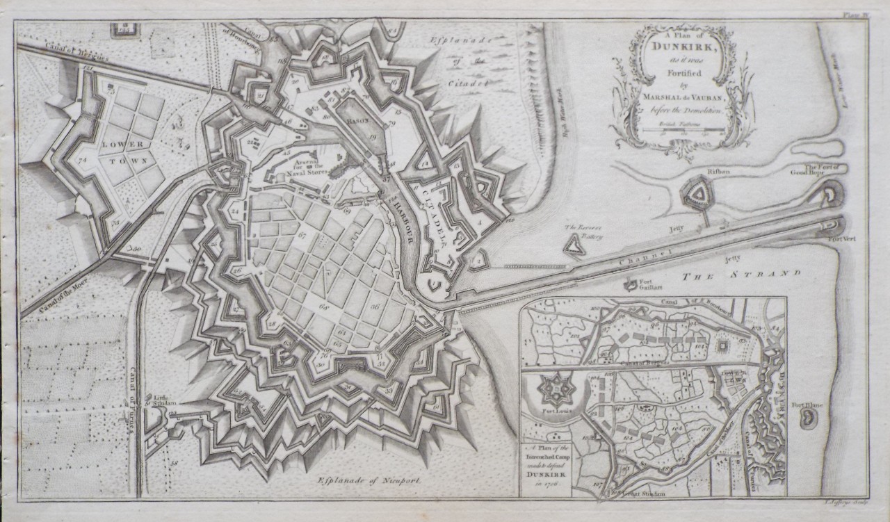
A Plan of Dunkirk, as it was Fortified by Marshal de Vauban, before the Demolition.
Ref: P/28288
Region: Dunkerque
Type: Copper
Engraver: Jefferys T

93%
A Map of Wilt Shire
Ref: P/8002
Region: Wiltshire
Type: Copper
Cartographer: Kitchin T
Engraver: Jefferys T
Date: 1749

Not for sale
93%
A Map of Bedfordshire.
Ref: P/13832
Region: Bedfordshire
Type: Copper
Publisher: Kitchin and Jefferys
Date: 1749

Sold
91%
Wiltshire wth Salisbury Citty & Stone heng described Ano 1689
Ref: P/17951
Region: Wiltshire
Type: Copper
Cartographer: Saxton C
Engraver: Hogenberg R
Publisher: Thomas Jefferys
Date: 1749

Not for sale
91%
Plan of the City of Nantes.
Ref: P/28239
Region: Nantes
Type: Copper
Engraver: Jeffereys T

91%
A Map of Wilt Shire
Ref: P/6854
Region: Wiltshire
Type: Copper
Date: 1775

Not for sale
90%
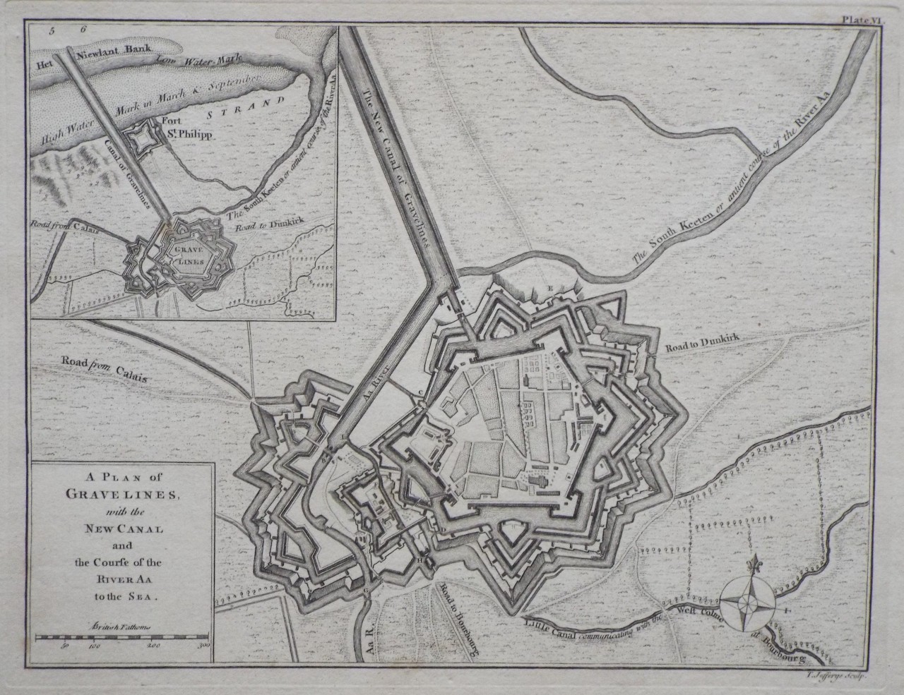
A Plan of Gravelines, with the New Canal and the Course of the River Aa to the Sea.
Ref: P/28289
Region: Gravelines
Type: Copper
Engraver: Jefferys T


Displaying 10 to 20 of 22